Ahu O Laka: History of the Kaneohe Bay Sandbar
The cultural significance, geological history, and famous landmarks of Kāneʻohe Bay
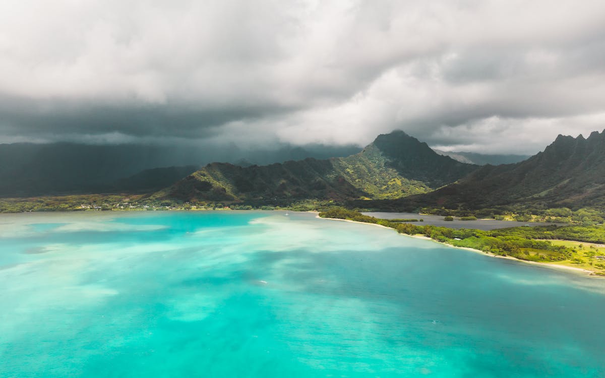
Photo by Jess Loiterton / Pexels
The Hawaiian Name: Ahu O Laka
Ahu O Laka translates to “The Altar of Laka” in the Hawaiian language. Laka is the Hawaiian goddess of hula, the forest, and wild plants. In Hawaiian mythology, she is revered as the patroness of the sacred art of hula.
The sandbar was considered a sacred place where offerings were made to Laka. Hula practitioners would come to this spot to honor the goddess and seek her blessings. The connection between this natural formation and the spiritual practice of hula gives the sandbar a significance that goes far beyond its physical beauty.
When visiting the sandbar, you are standing on a place that has been meaningful to the Hawaiian people for centuries. Treating it with respect by following tour guidelines, not littering, and learning about its cultural context is an important part of the experience.

Geology: How the Sandbar Formed
From Volcano to Lagoon
Kāneʻohe Bay sits inside the remains of an ancient caldera, the collapsed crater of the Koʻolau volcano, which last erupted roughly 2.6 million years ago. After the volcano went dormant, wind, rain, and waves slowly carved the dramatic cliffs you see today (the Koʻolau Range), while the ocean flooded the caldera floor to create the bay.
Over thousands of years, coral colonies grew along the bay’s outer edge, building up a massive barrier reef roughly 10 km long and 2 km wide. This is the only true barrier reef in the main Hawaiian Islands and one of very few in the entire United States.
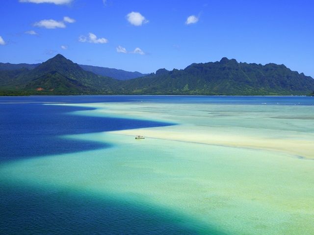
How the Sandbar Formed
Ocean currents flowing in and out of the bay with each tide deposited sand, coral fragments, and sediment along the top of this reef platform. Over millennia, that sand accumulated into the formation we know today: a three-mile-long sand ridge that rises and falls with the tides.
At low tide, the sand emerges above the waterline, creating a walkable beach in the middle of the ocean. At high tide, it slips 2 to 4 feet underwater, transforming into a shimmering turquoise lagoon. The surrounding barrier reef protects the bay from large ocean swells, creating the calm, crystal-clear conditions that make this place so special.
Kāneʻohe Bay: A Brief History
- Ancient Hawaiian settlement: The bay and surrounding valleys (Heeia, Kahaluu, Waiahole) were among the most fertile and populated areas of ancient Oahu. The bay provided abundant fish, and the valleys were rich in taro cultivation.
- Fishponds: Kāneʻohe Bay was home to numerous ancient Hawaiian fishponds (loko iʻa). Heeia Fishpond, near the boat harbor where tours depart, is one of the most well-known and is being actively restored.
- World War II: Marine Corps Base Hawaii (MCBH) at Kāneʻohe Bay was one of the first targets during the attack on Pearl Harbor on December 7, 1941. The base remains active today.
- Modern conservation: The bay has been the focus of significant environmental research and conservation efforts, particularly around coral reef health and invasive species management.
Famous Landmarks Visible from the Sandbar
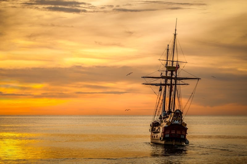
🎬 Pirates of the Caribbean
The sandbar gained international fame as a filming location for Pirates of the Caribbean: On Stranger Tides (2011). The turquoise shallow waters surrounded by the Koʻolau Mountains created a convincing tropical pirate backdrop.

🌴 Coconut Island (Moku O Loe)
Home to the Hawaii Institute of Marine Biology (University of Hawaii). Also famously featured in the opening credits of Gilligan’s Island. Visible from the sandbar but not open to the public.

⛰️ Mokoliʻi (Chinaman’s Hat)
A distinctive conical island just offshore from Kualoa. According to Hawaiian legend, Mokoliʻi is the tail of a giant lizard (moʻo) slain by the goddess Hiʻiaka. A beloved feature of the Kāneʻohe Bay landscape.
Respecting the Culture
The Kaneohe Bay sandbar is more than a beautiful place to swim and take photos. For the Hawaiian people, this is a place of deep cultural and spiritual meaning. Visitors play an important role in preserving both the environment and the traditions connected to it.
- Respect the natural environment. Do not take sand, shells, or coral from the bay
- Follow all tour guidelines, especially the 10-foot rule around sea turtles
- Leave no trace. Take all trash with you when you leave
- Take time to learn about the Hawaiian history and traditions of Kāneʻohe Bay
- Support local businesses and tour operators who care for this place
Experience the Sandbar
Visit this culturally significant and naturally stunning destination on a guided tour:
Back to The Ultimate Guide → | Snorkeling Guide → | FAQ →
All photos courtesy of HawaiiActivities.com / VELTRA Inc. unless otherwise noted. Used with permission.
